Utah's Most Underrated Backpacking Route! Death Hollow via the Boulder Mail Trail
BACKPACKING DEATH HOLLOW VIA THE BOULDER MAIL TRAIL
With an exceptional amount of opportunities for backpacking, Utah is known as a mecca when it comes to outdoor activities. Backpacking as one of those activities has no shortage of trails to choose from, particularly in the southern half of the state. This happens to be my favorite area of the state with many many incredible experiences. But there's one trail that really stands out to me as a must-do trail for anyone visiting the area.
Now you may think i'd be here to talk about Coyote Gulch, which is also an incredible trail and canyon to explore, but im here to talk about backpacking Death Hollow, specifically the lower end of the canyon below the Boulder Mail Trail.
Death Hollow is not to be confused with a similarly named canyon to the south east called Little Death Hollow. This route is for Death Hollow that is between the towns of Boulder and Escalante, Utah.

Death Hollow as you drop in from the canyon rim above
What I love about this route is the diversity of terrain you cover, the views and beauty of the canyon. As you travel over the Boulder Mail Trail you move through a rugged area of juniper, cactus and ups and downs of canyon drainages. Eventually you get to the rim of Death Hollow wondering how you're actually going to descend into the canyon. But there's a way, and the history of the Boulder Mail Trail gives pause to the tenacity of the ancient people who called this home, and settlers who moved into the Escalante and Boulder areas.
A simple quick history of the BMT is this. The reason it's called the Boulder Mail Trail is because it was the route used by mail carriers to deliver mail to the town of boulder before the highway was created. Boulder was one of the last, if not the last town in Utah to receive mail by horse, and to think horse teams delivered mail and goods via this route is amazing. While hiking the BMT you can even see the old telegraph line used to connect Escalante to Boulder. Truly it's an area full of history.
IMPORTANT DETAILS:
- There are multiple ways to do this route. The detailed description below is my preferred route
- Time Required: Ideally 3 Days/2 Nights
- Length: About 20 miles
- Shuttle required or 2 vehicles (Escalante may offer shuttle services from outfitters in the town, but no references offered here)
- A lot of time spent walking in the river itself, you will have wet feet and in certain times of the year the water can be cold
- Poison Ivy is prevalent in Death Hollow. Be aware and prepared
- Permits are required with group sizes under 12 people
- Dogs are allowed, but poop must be picked up and packed out
- WAG (Human Waste Bags) are preferred as campsites are limited and getting 200' from water can be difficult
- Fire are not allowed
- Route would be classified as moderate to difficult. Due to the length, exposure to steep cliffs, and difficulty of walking in the stream
- Please follow Leave No Trace principles and be a good steward of the land. Respect Native ruins, sites, petroglyph and pictograph panels
THE ROUTE:
The route for backpacking Death Hollow is what's known as a point to point hike that requires a shuttle, or two vehicles.
Starting Trailhead: Boulder Mail Trail (Accessed from Hell's Backbone Road/Boulder Airstrip)
Ending TrailHead: Escalante River Trail (Highway 12 Bridge Trailhead)
Starting at the Boulder Mail Trail (BMT) you'll get your permit at the trailhead (Required) and begin hiking down the BMT through a forest of juniper trees and fairly simple walking. About 2 miles in you'll find yourself at the edge of a view overlooking the Sand Creek drainage and a large swath of Navajo sandstone. As you descend the slick rock pay attention to the cairn (stacks for rocks) trail markers as the trail walks over large sections of slickrock sandstone. It can be easy to lose the trail and start wandering.


About 2.5 Miles into the hike you will find yourself at the Sand Creek drainage and you'll see Sand Creek flowing. The BMT follows Sand Creek for a short period (about 1/8 mile) and then exits Sand Creek and makes a climb out of the canyon. Look for a cairn and obvious trail that kicks off to your right and makes its way up a steep slick rock section. From here you slowly climb your way back up to the top of the plateau. Be sure to pay attention to the cairn trail markers so you don't get off track.
Eventually you'll find yourself at a high point and walking through sand areas dancing through more juniper and sagebrush before the trail makes an obvious move to the west and starts to descend toward Death Hollow. Total distance to this point is about 6.5 miles.

From here, again, pay attention to the cairn trail markers as they will guide you to the several hundred foot descent into the canyon bottom. It may not seem like this is doable as the slick rock seems to roll off the edge with no option, but eventually you'll start to zigzag down switchbacks that get you to the canyon bottom and to the stream running through the canyon.

Once you get to the bottom of the canyon, be aware that it's time to get your feet wet, and notice the presence of poison ivy. Attempting to keep your feet dry at this point is not worth the effort. While there is not established trail, there are obvious social trails and paths to follow that take you in and out of the water.


An abundance of poison ivy while backpacking death hollow
Make note that if you're planning to camp in the canyon bottom, there are a couple of great campsites just below where you drop into the canyon from above, and a couple up stream from where you drop in from above. This trail can be busy during the Spring and Fall months. So take note of the groups ahead of you at the permit register and plan your camping accordingly.
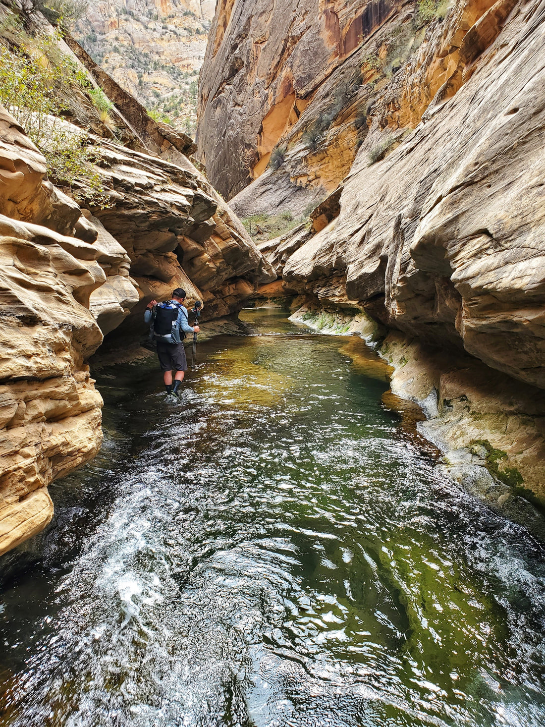
The next several miles of walking follow the stream and stay in the water until you reach the Escalante River. But there's plenty to see and enjoy as you walk down Death Hollow. Tall walls , lush vegetation, and swimming holes make it a beautiful and enjoyable experience. On a hot day the option to swim is plentiful and a nice way to cool off when stopping for lunch.

A favorite and likely the most scenic section of the canyon, known as the narrows, is a highlight of the canyon. About 2.5 miles up from the confluence with the Escalante River the walls tighten up and a narrow section of the stream cuts through the rock. This can be a tricky section as it changes every year. There is a large hole in the rock that can either be a swimming hole or filled with sand. If there's no sand in the hole from floods washing it out, you're having to carefully traverse a ledge in the stream on the left side. With a large backpack on it can be tricky, but it's not overly technical. Just take your time as it can be slippery.

As you work your way down the last section of Death Hollow there's much to enjoy as the canyon stays fairly narrow with big tall walls. Just before getting to the confluence of the Escalante river, there are a couple of campsites that are river left that make for a great option if the main sites are occupied at the confluence.
Once you reach the Escalante river, my preferred exit is to continue down stream along the Escalante River. It's 7 miles of walking from the confluence to the trailhead at the highway 12 bridge. But don't let this section be too quick as there is a lot to see and with likely a big day in Death Hollow, you'll find yourself camping for another night.
My favorite campsites are at the mouth of Sand Creek which is 4.5 miles down the Escalante River from the Death Hollow confluence. This makes for a quick exit of just under 3 miles to the bridge, but be sure to stop and enjoy Escalante Natural Bridge and the native ruins high on the canyon wall.
Having done this route a handful of times now, it never gets old and is one of my favorite places to take folks new to backpacking. It's just hard enough to push yourself physically, but not so hard that it takes away from the experience. This area is rich with history of the ancient people who called this area home, and is stunning in its beauty. Please be respectful of the area. Carry out your trash, use WAG bags for your human waste, and be a good steward of the land. Because of the nature of the trail and campsites being heavily used throughout the season, please be smart with your food to avoid training rodents to dig into food bags.
Enjoy the beauty and experience that the Escalante area provides, and enjoy a relaxing trip by backpacking death hollow!
